A powerful nor’easter is set to slam the Northeast this weekend, prompting a blizzard warning across New York City as officials brace for up to a foot or more of snow.
Eric Adams said the city is mobilizing earlier and with upgraded resources to respond to the approaching storm, which could bring significantly more snow than the previous system that battered the region.
“For context, the city hasn’t seen a blizzard warning in nine years,” Adams noted, emphasizing the seriousness of the forecast.
The mayor said snowfall totals could exceed the last major storm by as much as six inches. However, he expressed cautious optimism about post-storm conditions.
“Unlike in the prior storm, we are predicted to have the assistance of Mother Nature this time around,” Adams said. While temperatures are expected to dip into the low 20s in the coming days, forecasters predict highs returning to the 40s by Wednesday, which should help melt lingering snow piles.
Increased Pressure on Storm Preparedness
The mayor faces heightened scrutiny over storm readiness following the previous winter system, after which at least 19 people were found dead outdoors amid prolonged extreme cold. The tragedy led to City Council oversight hearings and renewed focus on emergency preparedness.
While plows were deployed early during the last storm and were not considered the primary issue, this upcoming nor’easter may test snow removal efforts more aggressively. Heavy snowfall rates of up to two inches per hour are possible, creating dangerous travel conditions.
In preparation, the city has restarted homeless encampment sweeps across the five boroughs to ensure vulnerable individuals are directed to shelter. During the last storm, schools were moved to remote learning for a day. It remains unclear whether a similar decision will be announced at the mayor’s upcoming briefing.
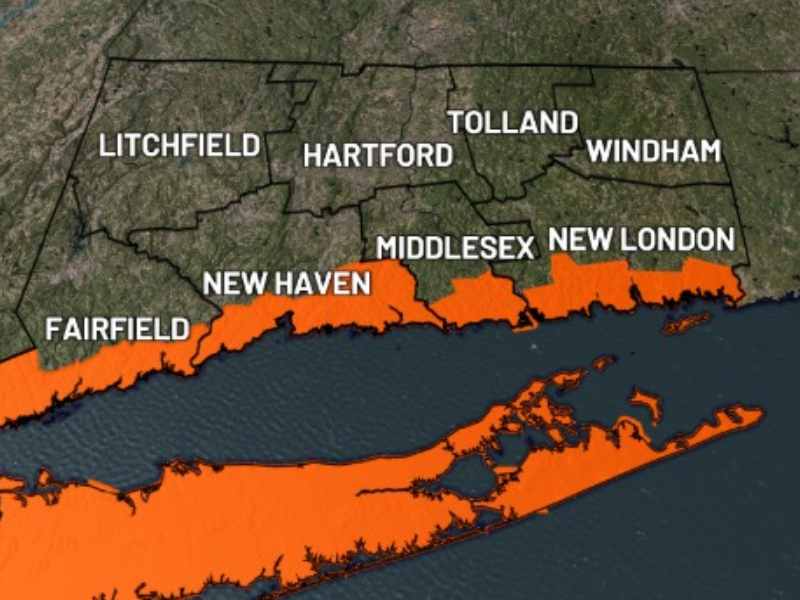
Blizzard Warning Across the Region
A blizzard warning has been issued for all five boroughs of New York City, as well as Long Island and much of New Jersey.
Under blizzard warning criteria, snowfall totals could reach between 13 and 18 inches, with wind gusts up to 55 mph. Such conditions are expected to reduce visibility to less than a quarter mile at times, creating whiteout conditions and significant travel disruptions from Sunday into Monday.
Meteorologists warn that the combination of heavy snow and strong winds could lead to hazardous roadways, flight cancellations, and potential power outages.
City officials are urging residents to avoid unnecessary travel, monitor official updates, and prepare emergency supplies as the storm approaches.
With memories of the last deadly cold spell still fresh, city leaders are under pressure to ensure this winter storm response is swift, coordinated and effective.